
AxisLine Land Survey
Land Survey
Welcome
Welcome to AxisLine Land Surveyor, where precision feels personal. We turn complex land questions into clear, usable answers for homeowners, builders, and design teams. From boundary and topographic surveys to ALTA/NSPS title work, construction layout, mortgage surveys, and FEMA elevation certificates, our maps are readable, our timelines reliable, and our communication plain. Share your address, goal, and deadline; we’ll scope the right survey and explain what the results mean for permits, budgets, and schedules. Proudly serving Port St. Lucie, FL, we measure carefully, think critically, and deliver on time, so you can plan, build, and close with confidence every time.
-
![Surveyor in a red cap uses surveying equipment on a tripod outdoors; casting a shadow on a light gray surface.]()
-
![Surveying instrument on tripod, orange and white target, blurred street background.]()
-
![]()
About Us
At AxisLine Land Surveyor, precision isn’t a buzzword; it’s a promise. We pair disciplined fieldwork with plain-English communication, so you always know what the numbers mean for your project, budget, and timeline. Our team brings deep experience across residential lots, commercial sites, and public works, using modern instruments and thoughtful QA to deliver results that hold up in permitting offices and at closings. If something in the record conflicts with what’s on the ground, we surface it early and offer practical options. Expect transparent proposals, reliable schedules, and deliverables your partners can use without translation. From the first call to the final plat, we make complex land questions feel simple—and give you the confidence to move forward.
-
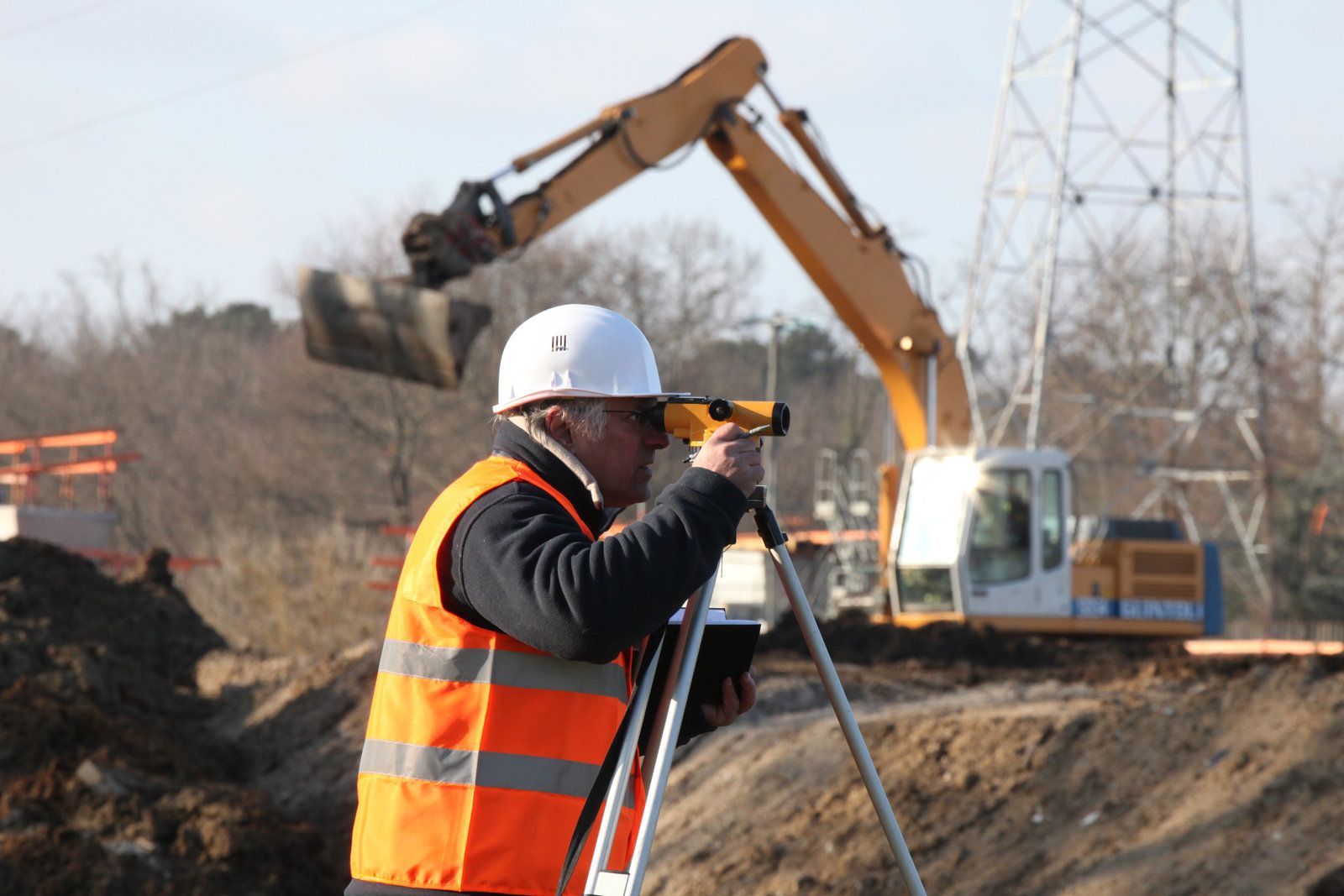
![Construction worker in a hard hat and safety vest uses a level. An excavator and power lines are in the background.]()


Services
If the map isn't good, your decisions won't be either. From boundary surveys that establish the true location of lines to topographic maps that allow designers to accurately model grades and drainage, from ALTA/NSPS title surveys that instil confidence in lenders and underwriters to construction layouts that keep crews on tolerance, from mortgage surveys that prevent closing surprises to FEMA elevation certificates that insurers and communities rely on, AxisLine Land Surveyor is the surveying backbone of every stage. We adapt our scope to meet your needs, work seamlessly with contractors, engineers, and lawyers, and provide you with editable CAD and PDF files that can integrate with your existing system. Is a combined scope or rapid revision required? Rapidity and auditability are key to how we organize our data. Our service is characterized by fewer delays, clearer choices, and better outcomes.
Boundary Surveys
Protect your investment by knowing exactly where it begins and ends. AxisLine Land Surveyor delivers boundary surveys that combine diligent records research, precise field work, and clear documentation—so you can build, buy, refinance, or resolve a dispute with confidence. Our team explains your results in plain language and provides a clean, professional plat you can share with title companies, lenders, contractors, and neighbors. From locating corners and lines to identifying encroachments and setback concerns, we give you answers you can act on. If you’re planning improvements, closing on a property, or simply want peace of mind about your perimeter, partner with the surveyors who put accuracy and communication first. One survey, done right, can prevent years of uncertainty.
Topographic Surveys
Design moves faster when your base map is trustworthy. AxisLine Land Surveyor delivers topographic surveys that capture the real conditions of your site—elevations, contours, drainage paths, structures, and visible utilities—so architects and engineers can draw confidently, and contractors can build without costly do-overs. We start by clarifying your scope and accuracy needs, then collect dense, defensible data with modern instruments and thoughtful field methods. Back in the office, we QC every point, model the surface with careful breaklines, and deliver clean, layered files in the formats your team prefers. From single-lot additions to multi-acre developments, our topo maps reduce risk, streamline permits, and keep budgets on track. When clarity counts, put a precise, readable foundation under every design decision.
ALTA/ACSM/NSPS Title Surveys
When your deal depends on certainty, choose the survey built for lenders and title underwriters. AxisLine Land Surveyor delivers ALTA/NSPS Land Title Surveys that align careful records research with precise fieldwork to reveal encroachments, access rights, easements, and other conditions that influence risk, value, and feasibility. We clarify scope up front, coordinate with counsel and the lender, and produce clean, closing-ready maps and CAD files that designers can build on. Need Table A options such as parking counts, utility coordination, or topography? We tailor the scope to your checklist and timeline. From acquisitions and refinancing to ground-up development, our disciplined process removes guesswork, so projects advance without last-minute surprises. If you want clear answers, proactive communication, and deliverables your entire team can trust, put our experience to work on your next transaction.
FEMA Flood Certification Surveying
When flood decisions hinge on inches, accuracy matters. AxisLine Land Surveyor delivers FEMA Elevation Certificates and flood certification surveys that insurers, lenders, and communities trust. We measure what counts—lowest floor, adjacent grade, openings, and equipment—tie it to the correct map and datum, and package it in a clear, signed/sealed certificate with photos and easy-to-read exhibits. Planning a renovation near grade? Challenging a mapped designation with a LOMA or LOMR-F? Want to understand how mitigation could affect your premium? Our team explains your numbers, outlines options, and coordinates with the professionals on your file so nothing gets lost in translation. From first call to final certificate, we turn complicated acronyms into straightforward answers you can take to the bank—and to your next permit counter.
Construction Surveying
Keep your schedule tight and your tolerances tighter. AxisLine Land Surveyor provides construction surveying that turns complex plans into crisp, buildable layouts—control networks, foundations, anchor bolts, utilities, paving, and finish grades delivered with precision and speed. We coordinate directly with your superintendent, align with pour sequences, and produce clean cut sheets and as-builts that your inspectors will appreciate. Our instruments are modern, our workflows are traceable, and our communication is plain and fast. Need an early-morning grid, a same-day revision, or a last-minute sleeve layout? We're built for the pace of active jobsites. From groundbreaking to closeout, we help you avoid rework, hold tolerances, and move confidently through each milestone. Put dependable layout under every crew—and keep the project momentum where it belongs: forward.
Mortgage Surveys
The fastest way to derail a closing is a last-minute surprise on the survey. AxisLine Land Surveyor keeps your transaction on track with mortgage surveys that give lenders, title professionals, and buyers a shared, reliable picture of the property. We verify boundaries and improvements, note encroachments and easements, and spot conflicts before they become expensive. Our approach is simple: communicate early, measure carefully, and deliver a clean, readable plat with the right certifications for your file. Need a quick re-certification for a new lender name or revised closing date? We handle it efficiently because our data is organized for speed and accuracy. Whether you’re buying, selling, or refinancing, put a precise, closing-ready survey behind your decision and move to the finish line with confidence.

Get a Free Quote Today!
Contact Us
Contact Us Today
Tell us where your project stands and where it needs to go—we’ll chart the shortest path. When you reach out to AxisLine Land Surveyor, you’ll get a quick, no-nonsense proposal with scope, schedule, and pricing aligned to your deadline. Share your address, goal (permit, design, construction, closing, dispute, or as-built), and any documents you have; we’ll take it from there. Throughout the job, a single point of contact keeps you updated while our field crews and drafters move efficiently from control to deliverables. Need DWG and a plotted set? A re-certification for a new lender name? A same-day layout tweak? Consider it handled. We make it easy to start, simple to track, and satisfying to finish—so you can focus on the next milestone.

“AxisLine Land Surveyor made a complicated decision simple. Before I installed a fence, they located every corner, explained the map, and flagged an old encroachment we never knew about. The crew was punctual, respectful, and fast. Their final plat saved us headaches and cleared title questions. I'd hire them again without hesitation. Accurate, affordable, and trustworthy from start to finish."

“AxisLine’s topo map changed our project. The team explained what the grades meant for drainage, caught a low spot near the patio, and helped us reroute a swale before plans went to the city. Files dropped into our engineer's workflow perfectly, saving time and money. Professional, punctual, and crystal-clear communication. We'll use them again on the next phase."
